Arizona Map

Request Free Visitor Guides

Waterdog Lake Trail

Basics
Location:
75 miles southwest of Gunnison
Setting:
Mountainous
Length:
7.2 mile roundtrip
Difficulty:
Intermediate
Time:
3.5 to 4.5 hours
Trailhead Elevation:
8600 feet
Elevation Change:
2500 feet
Season:
June - October

Description

Waterdog Lake Trail begins on the edge of Lake City, eliminating a long distance drive. After covering some beautiful territory, the trail ends at scenic Waterdog Lake. This is a good spot for fishing, camping or a picnic. It is also a beautiful area during the change of fall colors in mid September.

From the sewage treatment plant, walk along the road for _ mile. Just before the first house you see look for a sign on the right that indicates where the trail leaves the road. Please stay on the trail for the first _ mile or so as it passes through private land. Climbing steadily up the rocky hillside, the trail reaches public land near the power line. Along this first climb, turn around to catch some sights of Lake City. Continuing on public land for another mile through a large stand of aspen, the trail comes to the north end of scenic Horse Park. This area is privately owned and hikers are not allowed to travel any further south. At this point, follow the sign as the trail turns left (northeast) sharply and continues through aspen for about a mile. Most of this stretch is also private land, so please stay on the trail. Eventually crossing a creek, the trail joins a jeep road. Turn left and follow the road on up to Waterdog Lake.

Hazards/Considerations: Make sure to stay on the trails when crossing private land. Signs are posted, indicating when public lands are being entered and exited. Signs also point in the direction of the trails that need to be followed. It is important to be prepared for typical July and August afternoon thundershowers. Stay off ridges and away from open ground to avoid lightening strikes during storms. Be sure to bring sunscreen, raingear and drinking water. Remember, hiking at high altitude requires more time and energy. Take your time, enjoy the scenery and avoid overexertion. Be sure someone knows where you are going and when you plan to return.

Details

Location:
75 miles southwest of Gunnison
Setting:
Mountainous
Length:
7.2 mile roundtrip
Difficulty:
Intermediate
Time:
3.5 to 4.5 hours
Trailhead Elevation:
8600
Elevation Change:
2500
Season:
June - October
Camping Info
Camping permitted

Map + Directions

Basic Directions

Lake City is 60 miles southwest of Gunnison on Hwy 149.

Cross the bridge at the north end of Lake City from highway 149. Turn left and continue one block. Turn left again to the sewage treatment plant. Park just outside of the sewage treatment plant fence in the area indicated with signs.

Arizona Flagstaff Discover-Downtown-Gilbert

Copyright © 1997 - 2025 The Go Travel Sites. All Rights Reserved and.

Email Page Link

Complete the form below to email this page to a friend or family member's email. You can send yourself an email as well. Your email and your recipient's email will NOT be shared with anyone. See our full Privacy Policy for details.
:
:
:


:
Copy Yourself on the Email Yes No
:
:

1

Select one or more Free Visitor Guides below

2

Complete the form to receive your guides by mail

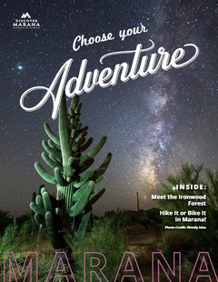
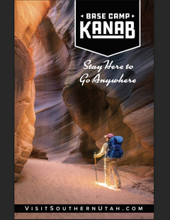
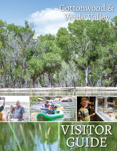
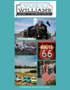
Below are the Free Visitor Guides for Flagstaff. More Visitor Guides are available in Arizona. Click here to view them all!

Catalina Island Catalina Island Catalina Island
Southern CaliforniaDiscover the magical island of Catalina, just off the coast of Southern California. Whether you are looking for a romantic getaway, a place to bring the entire family or need a few days to unwind, Catalina Island is the perfect destination. Note: We encourage visitors to use the 2024 digital guide. The 2025 printed guide will not ship until late January.
Request this Free Visitor GuideRequested! You're all set! Request a few more Visitor Guides, or complete the form below to receive your guides by mail.
Arizona - The Grand Canyon State Arizona - The Grand Canyon State Arizona - The Grand Canyon State
ArizonaStart planning your Arizona vacation with the Official State Visitor's guide - available in print, electronically, or both. Fill out the form to request your free travel packet, which includes an Arizona Official State Visitor's Guide and an Arizona state highway map. The Arizona Office of Tourism ships domestically as well as the following countries only: United Kingdom, Germany, France, Japan, Canada and Mexico.
Request this Free Visitor GuideRequested! You're all set! Request a few more Visitor Guides, or complete the form below to receive your guides by mail.
Sedona Sedona Sedona
Central ArizonaSedona is known by many as "Red Rock Country” and is a magical place of art and culture located in Central Arizona. Friendly locals and beautiful surroundings make this quite the popular destination.
Request this Free Visitor GuideRequested! You're all set! Request a few more Visitor Guides, or complete the form below to receive your guides by mail.
Arizona State Parks Arizona State Parks Arizona State Parks
State of ArizonaWhen it comes to epic beauty and dramatic diversity, no state compares to Arizona. Our trails are your key to unlocking a treasure chest of scenic wonders.
Request this Free Visitor GuideRequested! You're all set! Request a few more Visitor Guides, or complete the form below to receive your guides by mail.

Specialty Guides

Maverick Helicopters Maverick Helicopters Maverick Helicopters
Nevada, Arizona, Hawaii, and CaliforniaUnforgettable Tours Offered in Nevada, Arizona, Hawaii, and California.
Request this Free Visitor GuideRequested! You're all set! Request a few more Visitor Guides, or complete the form below to receive your guides by mail.